 Central Subtropical Atlantic:
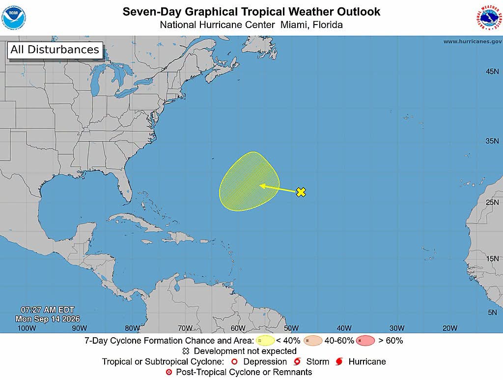
A trough of low pressure located a little more than 1000 miles east-southeast of Bermuda continues to produce disorganized showers and thunderstorms. Environmental conditions over the system are currently unfavorable for development due to strong upper-level winds. However, as the system moves west-northwestward across the central part of the Subtropical Atlantic, it is forecast to enter a more conducive environment for gradual development by the middle to latter portion of this week. It has a near zero chance of formation in 48 hours and a low (30 percent) chance in the next 7 days.
Central Subtropical Atlantic:
A trough of low pressure located a little more than 1000 miles east-southeast of Bermuda continues to produce disorganized showers and thunderstorms. Environmental conditions over the system are currently unfavorable for development due to strong upper-level winds. However, as the system moves west-northwestward across the central part of the Subtropical Atlantic, it is forecast to enter a more conducive environment for gradual development by the middle to latter portion of this week. It has a near zero chance of formation in 48 hours and a low (30 percent) chance in the next 7 days.
Traffic & Weather
Atlantic Tropical Weather Outlook

**** Via NOAA Hurricane Centre
Atlantic Tropical Weather Outlook
Central Subtropical Atlantic:
A trough of low pressure located a little more than 1000 miles east-southeast of Bermuda continues to produce disorganized showers and thunderstorms. Environmental conditions over the system are currently unfavorable for development due to strong upper-level winds. However, as the system moves west-northwestward across the central part of the Subtropical Atlantic, it is forecast to enter a more conducive environment for gradual development by the middle to latter portion of this week. It has a near zero chance of formation in 48 hours and a low (30 percent) chance in the next 7 days.
Central Subtropical Atlantic:
A trough of low pressure located a little more than 1000 miles east-southeast of Bermuda continues to produce disorganized showers and thunderstorms. Environmental conditions over the system are currently unfavorable for development due to strong upper-level winds. However, as the system moves west-northwestward across the central part of the Subtropical Atlantic, it is forecast to enter a more conducive environment for gradual development by the middle to latter portion of this week. It has a near zero chance of formation in 48 hours and a low (30 percent) chance in the next 7 days.