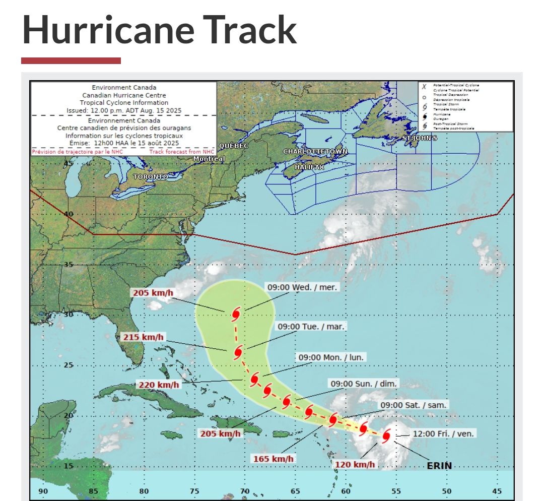
 (Environment Canada)
According to the National Hurricane Centre
"ERIN BECOMES THE FIRST HURRICANE OF THE 2025 SEASON
ERIN SE CONVIERTE EN EL PRIMER HURACÁN DE LA TEMPORADA DE 2025
(Environment Canada)
According to the National Hurricane Centre
"ERIN BECOMES THE FIRST HURRICANE OF THE 2025 SEASON
ERIN SE CONVIERTE EN EL PRIMER HURACÁN DE LA TEMPORADA DE 2025
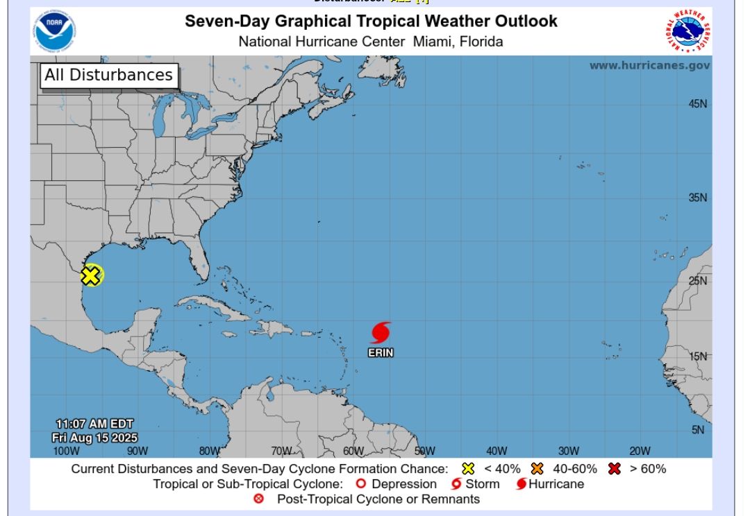 At 1100 AM AST (1500 UTC), the center of Hurricane Erin was located 460 miles east of the northern Leeward Islands. Erin is moving toward the west-northwest near 18 mph (30 km/h). This motion is expected to continue into the weekend. On the forecast track, the center of Erin is likely to move near or just north of the northern Leeward Islands over the weekend.
Reports from NOAA and Air Force Reserve Hurricane Hunter aircraft indicate that maximum sustained winds have increased to near 75 mph (120 km/h) with higher gusts. Steady to rapid strengthening is expected during the next two to three days, and Erin is forecast to become a major hurricane during the weekend.
Hurricane-force winds extend outward up to 25 miles (35 km) from the center and tropical-storm-force winds extend outward up to 115 miles (185 km) mainly to the north of the center."
-
At 1100 AM AST (1500 UTC), the center of Hurricane Erin was located 460 miles east of the northern Leeward Islands. Erin is moving toward the west-northwest near 18 mph (30 km/h). This motion is expected to continue into the weekend. On the forecast track, the center of Erin is likely to move near or just north of the northern Leeward Islands over the weekend.
Reports from NOAA and Air Force Reserve Hurricane Hunter aircraft indicate that maximum sustained winds have increased to near 75 mph (120 km/h) with higher gusts. Steady to rapid strengthening is expected during the next two to three days, and Erin is forecast to become a major hurricane during the weekend.
Hurricane-force winds extend outward up to 25 miles (35 km) from the center and tropical-storm-force winds extend outward up to 115 miles (185 km) mainly to the north of the center."
-
What to do when a Hurricane Watch or Warning is issued / During a hurricane / Keep Your Pets Safe in an Emergency: 8 Things You Need to Know
** Release