Sting jets
On Saturday, July 5, 2014, Hurricane Arthur transformed into a potent post-tropical storm over the Maritimes. The storm caused significant tree damage and widespread flooding by merging with a cold front. A very small area of extremely high winds, referred to as a “sting jet”, was formed to the left of the storm track. Areas around Greenwood, Nova Scotia and the Annapolis Valley even saw wind gusts of 138 km/h.
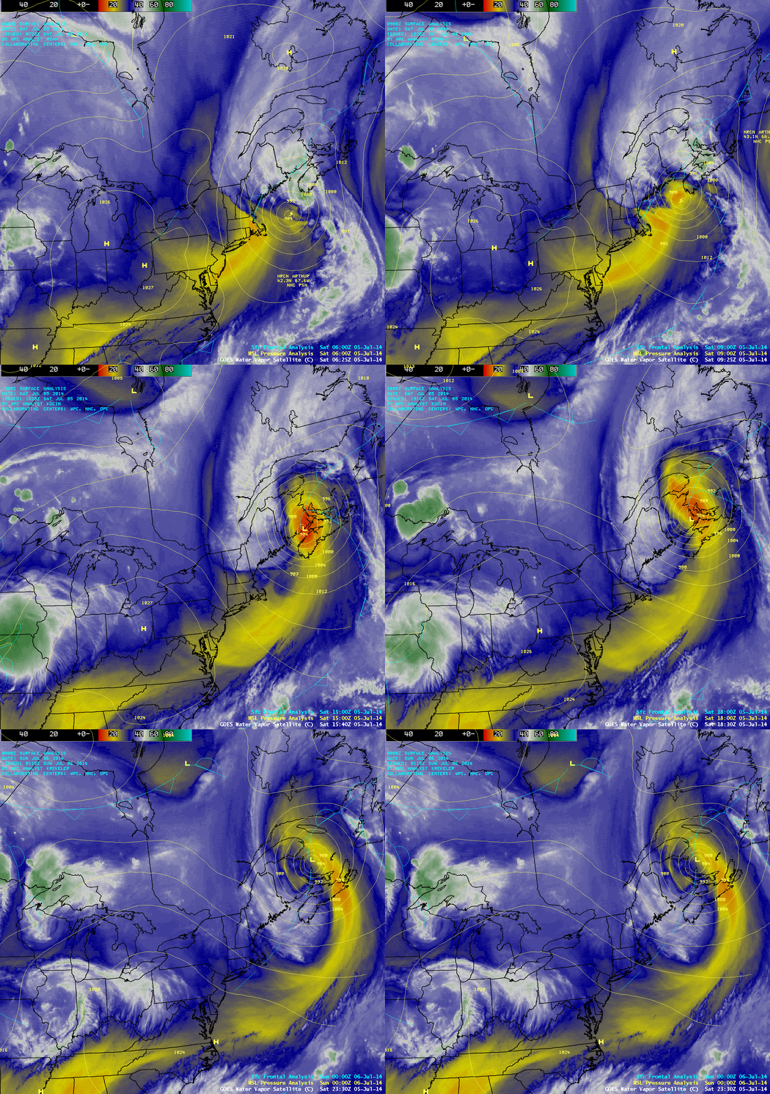 GOES-13 Satellite loop of Hurricane Arthur sweeping through the Maritimes. Credit: University of Wisconsin, Space Science and Engineering Centre.
So how does a sting jet form?
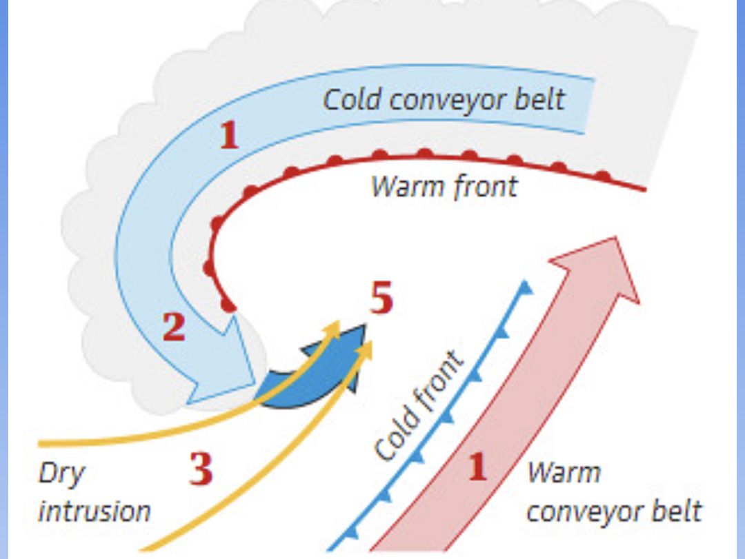
A sting jet is a small area of very intense winds within a storm that is hard to predict. Not all, except certain large and intense storms, have this feature. It typically forms where the cold conveyor belt (a flow of cold air from the north) interacts with the dry intrusion (a region of dry air descending from higher altitudes).
GOES-13 Satellite loop of Hurricane Arthur sweeping through the Maritimes. Credit: University of Wisconsin, Space Science and Engineering Centre.
So how does a sting jet form?
A sting jet is a small area of very intense winds within a storm that is hard to predict. Not all, except certain large and intense storms, have this feature. It typically forms where the cold conveyor belt (a flow of cold air from the north) interacts with the dry intrusion (a region of dry air descending from higher altitudes).