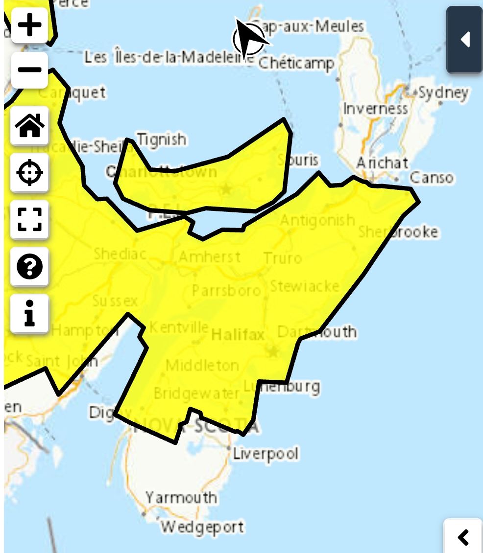
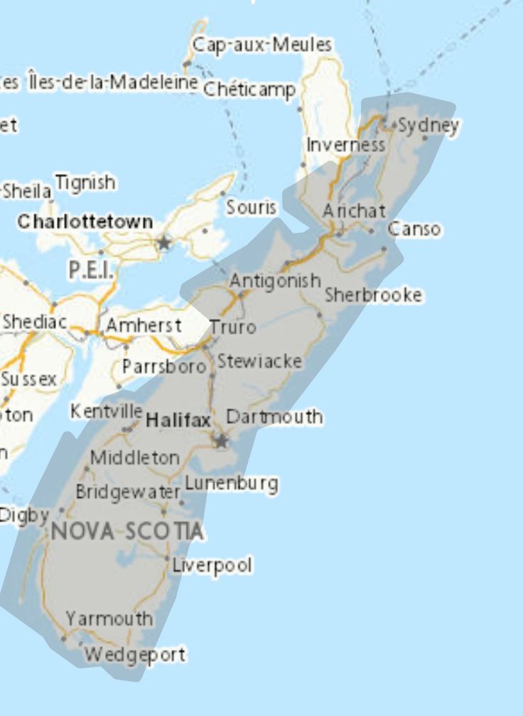
 Significant snowfall is possible.
Locations: most of Nova Scotia
Potential snowfall: 10 to 25 cm.
Time span: Wednesday into Thursday.
Remarks: A low pressure system will track south of Nova Scotia on Wednesday bringing snow to much of the province. Snow will begin over western Nova Scotia Wednesday morning and move eastward across the proving through the day reaching Cape Breton by Wednesday evening. Snow tapers to flurries Wednesday night over most areas but will likely persist into Thursday over eastern Nova Scotia. General amounts of 10 to 25 cm are possible but amounts could change with a change in the storm's track.
Please continue to monitor alerts and forecasts issued by Environment Canada. To report severe weather, send an email to NSstorm@ec.gc.ca or post reports on X using #NSStorm.
For more information about the alerting program, please visit: Colour-coded Weather Alerts.
Source
https://weather.gc.ca/index_e.html?alertTableFilterProv=NS¢er=45.34825715,-62.63479917&zoom=5
Significant snowfall is possible.
Locations: most of Nova Scotia
Potential snowfall: 10 to 25 cm.
Time span: Wednesday into Thursday.
Remarks: A low pressure system will track south of Nova Scotia on Wednesday bringing snow to much of the province. Snow will begin over western Nova Scotia Wednesday morning and move eastward across the proving through the day reaching Cape Breton by Wednesday evening. Snow tapers to flurries Wednesday night over most areas but will likely persist into Thursday over eastern Nova Scotia. General amounts of 10 to 25 cm are possible but amounts could change with a change in the storm's track.
Please continue to monitor alerts and forecasts issued by Environment Canada. To report severe weather, send an email to NSstorm@ec.gc.ca or post reports on X using #NSStorm.
For more information about the alerting program, please visit: Colour-coded Weather Alerts.
Source
https://weather.gc.ca/index_e.html?alertTableFilterProv=NS¢er=45.34825715,-62.63479917&zoom=5
Traffic & Weather
Special weather statement in effect

**** Via Environment Canada
Special weather statement in effect
Significant snowfall is possible.
Locations: most of Nova Scotia
Potential snowfall: 10 to 25 cm.
Time span: Wednesday into Thursday.
Remarks: A low pressure system will track south of Nova Scotia on Wednesday bringing snow to much of the province. Snow will begin over western Nova Scotia Wednesday morning and move eastward across the proving through the day reaching Cape Breton by Wednesday evening. Snow tapers to flurries Wednesday night over most areas but will likely persist into Thursday over eastern Nova Scotia. General amounts of 10 to 25 cm are possible but amounts could change with a change in the storm's track.
Please continue to monitor alerts and forecasts issued by Environment Canada. To report severe weather, send an email to NSstorm@ec.gc.ca or post reports on X using #NSStorm.
For more information about the alerting program, please visit: Colour-coded Weather Alerts.
Source
https://weather.gc.ca/index_e.html?alertTableFilterProv=NS¢er=45.34825715,-62.63479917&zoom=5
Significant snowfall is possible.
Locations: most of Nova Scotia
Potential snowfall: 10 to 25 cm.
Time span: Wednesday into Thursday.
Remarks: A low pressure system will track south of Nova Scotia on Wednesday bringing snow to much of the province. Snow will begin over western Nova Scotia Wednesday morning and move eastward across the proving through the day reaching Cape Breton by Wednesday evening. Snow tapers to flurries Wednesday night over most areas but will likely persist into Thursday over eastern Nova Scotia. General amounts of 10 to 25 cm are possible but amounts could change with a change in the storm's track.
Please continue to monitor alerts and forecasts issued by Environment Canada. To report severe weather, send an email to NSstorm@ec.gc.ca or post reports on X using #NSStorm.
For more information about the alerting program, please visit: Colour-coded Weather Alerts.
Source
https://weather.gc.ca/index_e.html?alertTableFilterProv=NS¢er=45.34825715,-62.63479917&zoom=5